

Dr Jean-François Parrot
The software TLALOC (Tridimensional Landscape Analysis Local Operating Computation) represents a powerful new tool to study the morphometry and geomorphology by using a Digital Elevation Model (DEM). In fact, nowadays, DEMs describe accurately the earth's surface and they offer the possibility to study in detail the various aspects of the relief. The existing commercial softwares only partially take into account this issue. Therefore, using the MS-DOS modules I develop since 2004 and that concern this issue (several publications have been realized), I began to integrate them into a software developed in the Windows environment with software Borland C + + Builder Version 6.
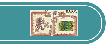
TLALOC is the Aztec god of rain, one of the major agents that model the Earth's surface. For this reason I have dedicated this software developed in the city of Mexico to this ancient deity
TLALOC uses DEM of 16 or 32 bits. There are three main windows: the first corresponds to the representation of the DEM or of its surface parameters (shade, aspect, slope, etc ...) allowing to generate three-dimensional blocks, on the second window calculated parameters that can be also superimposed on the DEM are displayed and on the third window appears the drainage network that can be used among other things to calculate secondary attributes in two and three-dimensional space.
The Main menu contains several submenus. 1) Files whose orders can open, import, export and keep images and DEM. Thus, there are interfaces between the software and various GIS. 2) DEM Form contains the following commands: DEM information, fractal dimension, three-dimensional vision, river network extraction or contour lines extraction, introduction of UTM coordinates. 3) Surface Parameters allows calculating directly from the surface a set of primary attributes such as slope, aspect, concavity, convexity, density contours, local fractal dimension, three-dimensional surface, the total depth, etc... 4) Drainage Network Parameters: once extracted the river network, this command appears and it is possible to calculate the attributes that need using the drainage network: Dissection Density (in quadrants or within a moving window, taking into account the pixel density or the length of the network), three-dimensional Dissection Density, fractal dimension of the river system or density of the headwaters.
The command Tools provide access to tools such as the color, histograms, etc... The command Windows defines the layout of the individual windows in use. Finally the command Info provides information about the software and the copyright.
It should be noted that TLALOC produces images of all parameters using the .raw format that allows initiating statistic treatments and cross-tabulations based on the real values of these parameters; this possibility occurs rarely in the various commercial softwares which refer mainly to visual interpretations. In addition, histograms and/or diagrams corresponding to each attribute can be saved.
J.-F. Parrot, Mexico, 2006
Download


