Catálogo General
Dr Jean-François Parrot
| Icon | Name | Date | Authors | Fonction |
 |
Brod4_Mx | 2012 | J.-F. Parrot | Transfer of a gray tone 8 bits image of the contour lines in an integer 4 image with hypsometric values |
 |
Crear_Tabla | 2012 | J.-F. Parrot C. Ramírez-Núñez | Creation of the table defining the correspondence between graytones and altitudes |
 |
DEM_Lidar | 2013 | J.-F. Parrot | DEM generation using LiDAR point cloud |
 |
Dilat_Curves | J.-F. Parrot | Interpolation (by using a dilation process) applied to the image provided by the module Brod4_Mx | |
 |
Gaussian_Lateral_Flooding | 2014 | J.-F. Parrot | Flood simulations by means of a Gaussian wave |
 |
Hiatus | 2012 | J.-F. Parrot | Small hiatus elimination used to join contour line segments |
 |
Miel4_Mx | 2012 | J.-F. Parrot | Multi-directional interpolation applied to the image provided by the module Brod4_Mx |
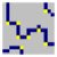 |
Net_Curve2 | 2012 | J.-F. Parrot | Pixel corner elimination in order to obtain a 8-vecinity contour line |
 |
NewDilat_Curves | 2012 | J.-F. Parrot | Interpolation (by using a dilation process) applied to the image provided by the module Brod4_Mx (new version) |
 |
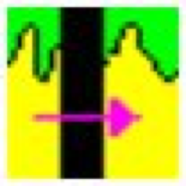
New_Fast_Cauce | 2012 | J.-F. Parrot C. Ramírez-Núñez | Hypsometric interpolation in a fluvial plain |
 |
NewMiel_V2 | 2012 | J.-F. Parrot | Multi-directional interpolation applied to the image provided by the module Brod4_Mx |
 |
River_Bodies | 2012 | J.-F. Parrot C. Ramírez-Núñez | Altitude of river surface and water bodie |
 |
River_Slope3 | 2014 | J.-F. Parrot | Generation of continuous river surfaces |
 |
Suav_Mask | 2012 | J.-F. Parrot | Smoothing inside a given zone |
 |
Sum_cn_ha_dxf | 2006 | J.-F. Parrot | Sum of two vector data file types (contour lines and water bodies) Sum of vector data files |
 |
Sum_dxf_V2 | 2006 | J.-F. Parrot | Sum of vector data files |
 |
Superpos_Rio | 2012 | J.-F. Parrot | River surface superposition on a DEM |
 |
Sup_River_Slope | 2014 | J.-F. Parrot | Superposition of the river surface provided by River_Slope3 on a DEM |
| |
Transf_dxf_V2 | 2005 | J.-F. Parrot | Vector to raster format transfer |